Super Terrain: Your Comprehensive Offline Mapping and Navigation App
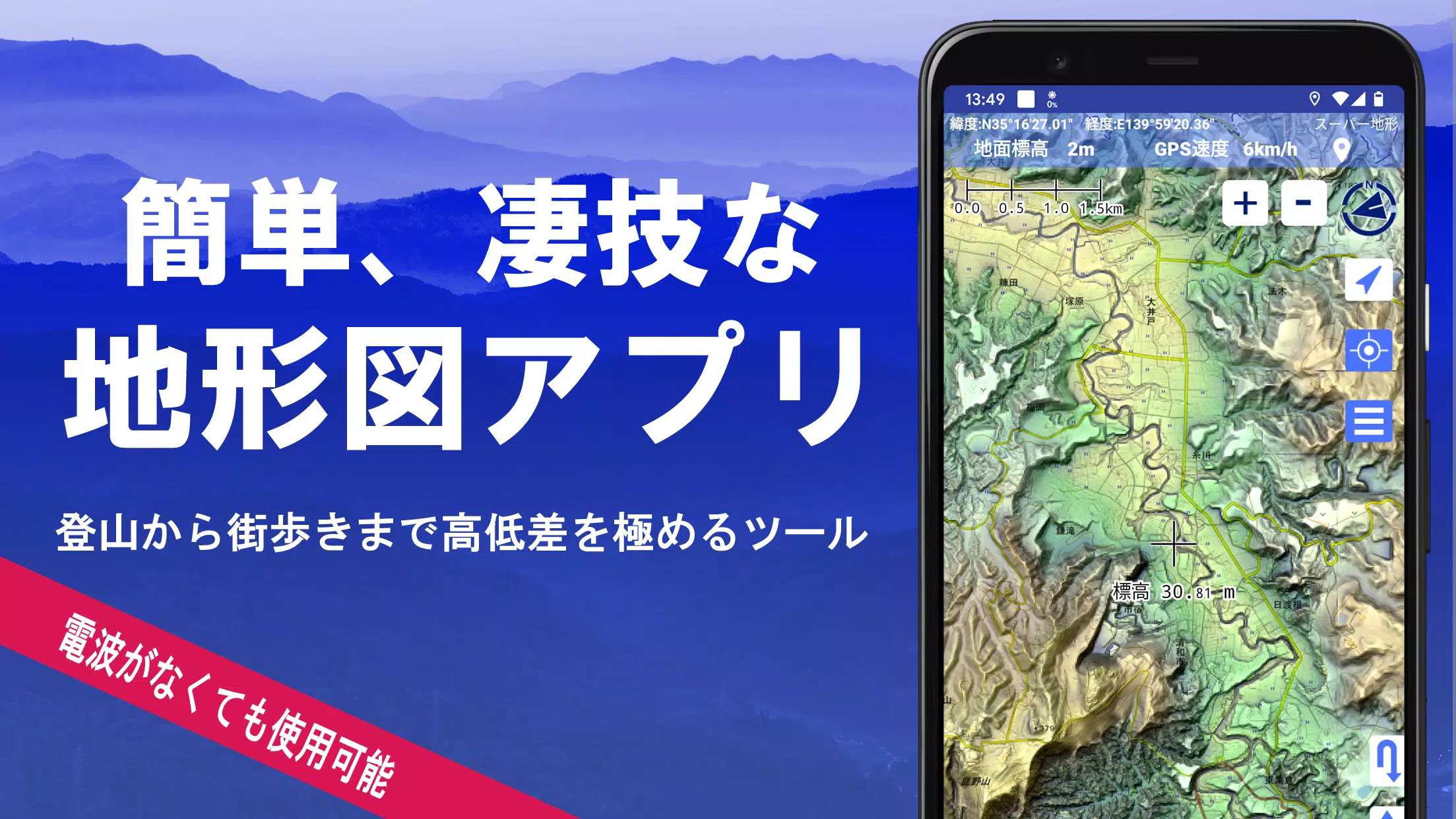
Super Terrain is a powerful mapping application boasting over 100 map types, including those from the Geospatial Information Authority of Japan (GSI), making it ideal for various activities from urban exploration to challenging mountain climbs. A recipient of the 2018 Japan Cartographic Society Award, Super Terrain offers unparalleled detail and functionality.
Key Features:
-
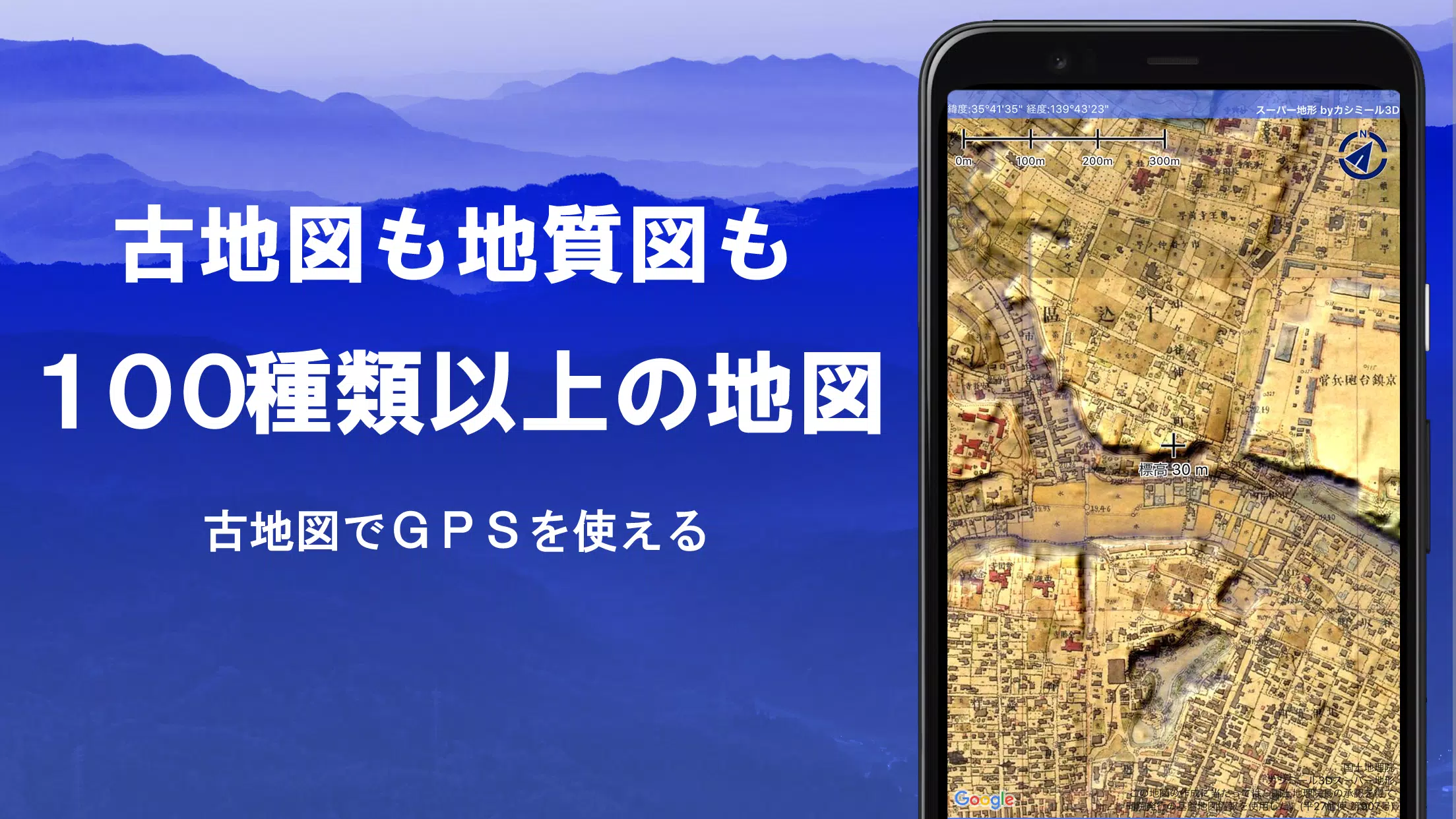
Extensive Map Library: Access over 100 map types, including GSI maps (topographic, geological, historical), plus unique "super terrain data" for enhanced elevation detail. Aerial photography is available, with the most comprehensive coverage for recent and circa-1974 imagery. A 5-day free trial of super terrain data is included.
-
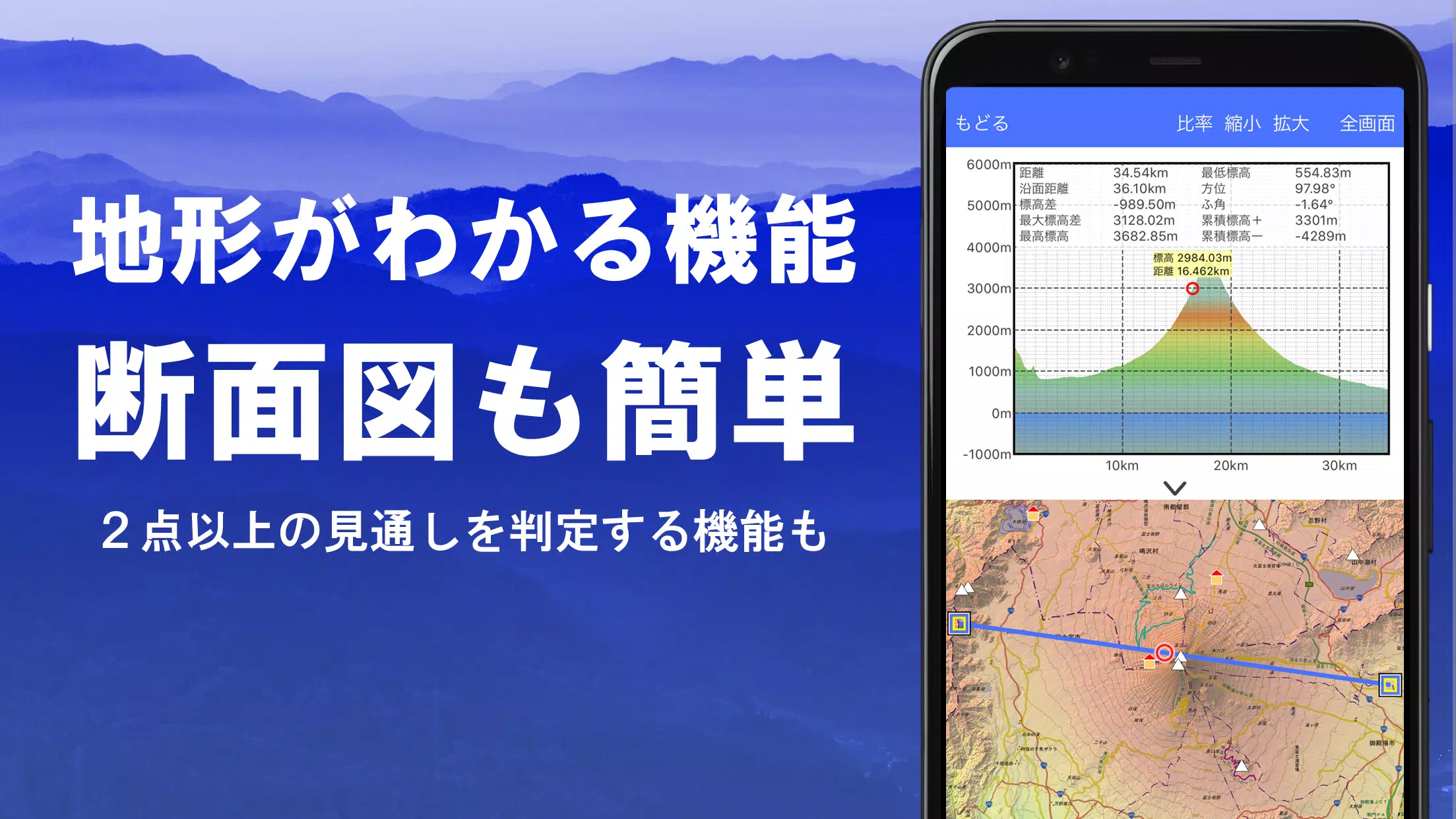
Advanced Terrain Analysis: Create precise cross-sections at any point on the map, incorporating Earth's curvature and atmospheric effects. Integrate building data (where available) for even more accurate visualizations. This functionality is invaluable for route planning, assessing wireless visibility, and understanding complex terrain.
-
Customizable Visualization: Utilize the elevation palette to personalize map colors with 1cm incremental adjustments.
-
360° Panoramic Views: Identify mountains and landmarks with the integrated panoramic view function, linked to your smartphone's compass. View the sun and moon (including moon phases) for planning activities like observing Diamond Fuji or Pearl Fuji. GPS point locations are also displayed.
-
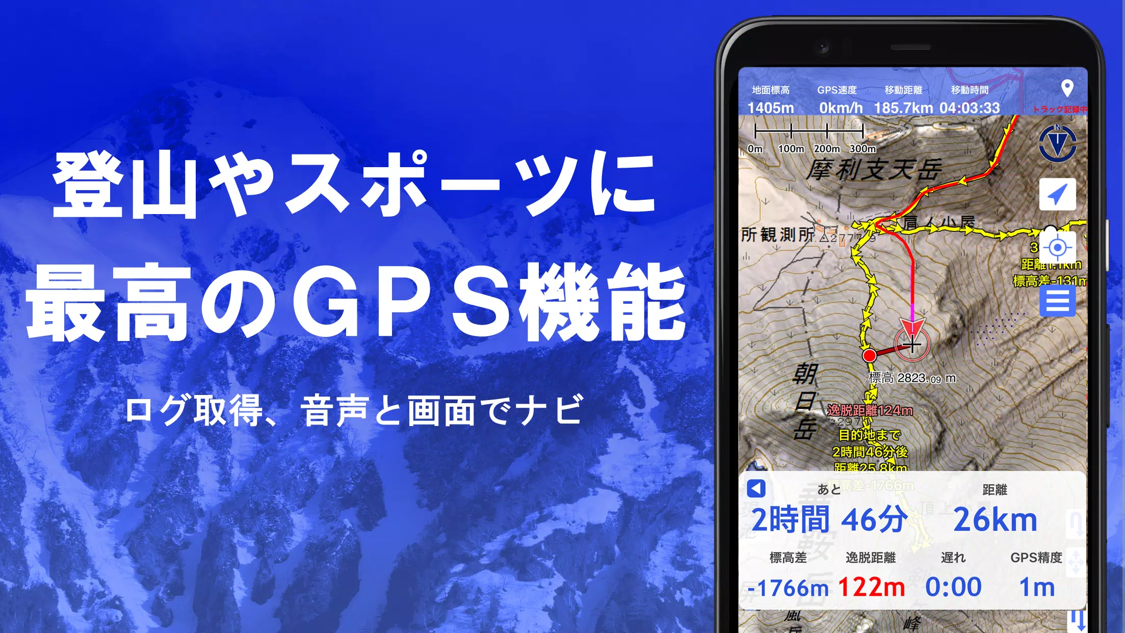
Robust GPS Functionality: Record high-precision tracks (GPX import/export and editing supported), complete with elevation change, speed, time, and elapsed time data. Receive voice and alarm notifications when approaching pre-set points. Share your map center location with NaviCon. Enjoy seamless track playback, automatically synchronized with your smartphone's photos.
-
Offline Capabilities: Download maps in bulk for offline use, ensuring uninterrupted access even in remote areas with no cell signal. A cache function further enhances offline usability.
-
Navigation & Tracking: Navigate pre-set tracks with Track Navi, receiving alerts if you deviate from the planned route. Additional navigation options include route navigation for urban areas and point navigation.
-
Data Management: Edit GPS points, routes, and tracks, organizing them with folder management and a user-friendly tree view. Create tracks directly on the map.
-
GIS Data Support: Import, display, and edit GIS data from GeoJSON files, including the ability to draw new shapes.
-
Output Options: Print maps at a specified scale or export them as PDFs.
-
Data Backup & Restoration: Back up and restore all app data (excluding cached maps) via Google Drive, ensuring data security.
-
Other Features: MGRS/UTM grid display, shape drawing tools, dark theme support, and compatibility with custom maps and other apps (Kashmir 3D, GPX, KML, GDB).
Pricing:
A yearly subscription of 780 yen unlocks premium features like super terrain data, advanced GPS functions, and cross-section views. A 5-day free trial is available upon installation. Automatic renewal can be managed through your Google Play account. Prices are subject to change.
Disclaimer: The copyright holder and developer are not responsible for the outcomes of using this application. Continuous GPS use will drain your battery; consider carrying a spare battery, especially for emergency situations. See the manual for detailed instructions and troubleshooting information (navigation guide available at https://www.kashmir3d.com/online/superdemapp/superdem_navi.pdf).